27 May To The Edge of the World and Back.
ORIGINALLY PUBLISHED IN GREAT WALKS MAGAZINE | JUNE 2020 EDITION.
On Friday the 13th, I flew to Melbourne with the intention of walking to the most southerly point of the Australian mainland. It was a journey I’d planned for some time. A couple of years ago my wife, two young daughters and myself had driven around the country, and we tried to tick-off the compass points along the way. Byron Bay on the east was easy. Cape York not so much. Steep Point on the west eluded us, though we came close enough to touch, and the southerly point involved too much walking for a two, and a six year old.
So a few years later this was my chance, and as a bonus, I was going to walk it with an old friend I don’t see very much anymore. Both of us busy with work, life and children. So I was really looking forward to it. Friday 13th was also, unfortunately, the day Coronavirus started to make an impact in Australia. As I stepped off the plane the Formula One was cancelled, the Pope was being tested for COVID-19 and people were wondering if they should really be going to work on Monday.
The global pandemic was beginning to take hold, and in the midst of all the fear and misinformation, the nonchalance and disdain, two old mates got ready to wander off into the wilderness. Both of us quite happy to be doing so.
South Point can only be reached on foot, and it’s a touch too far for a day walk so you’ve got to overnight to make the trip. Stuart had booked our camp site months ago, and all was confirmed as we checked in at the Tidal River visitor centre. They hand you a wee map, confirm your intended route then let you loose in the amazing Wilsons Promontory National Park.
Night at the prom
‘The Prom’ as it’s known to Melbournians, covers 128,000 acres of the most southerly peninsula on the mainland, and it’s a stunning place to be at the best of times, never mind when the world is going to pot. Parts of it you can drive to. But the best part, is that the best parts, you can’t. You have to walk to reach the silent expanses of deserted beach, the rugged headlands and verdant rainforests, and a glorious lighthouse perched on the very edge of the world. Or so it seems when you get there. It’s no wonder Aboriginal people were living here long before the Europeans arrived. It really is beautiful, and the surrounding waters plentiful. Middens have been found on the western side of the peninsula, giving an insight into the seafood diet enjoyed by the first Australians, around 6,500 years ago.

Back in the present, however, we decided on the most direct route south, leaving the meandering track for the return journey. So along with another few adventurous souls, we boarded the shuttle bus for Telegraph Saddle and arrived at the start of our walk a few minutes later. And despite the existential gathering storm, the sun was still shining. The sky was beautifully blue. A couple of perfect clouds drifted by, and all was well with the world. Mount Oberon looms to the right as you set off down a wide forestry track, and although you can see what looks like a mobile phone tower at the top, there was no reception to be had. Perfect.
Mount Oberon, and Martins Hill ahead, are actually two peaks of a long granite ridge that extends all the way down to Tasmania. And only 10,000 years ago you would have been able to walk the whole way.
But the seas rose, Tasmania was separated and the peaks became islands. Even South Point was set adrift, until a build-up of sand eventually created the Yanakie Isthmus, that we were just about to walk across. It’s a pretty easy, and uneventful trek to begin with. A flat, sandy stretch of soil that’s been populated with Eucalypts and scrub. But there’s always something to see if you look with the right eyes. Fortunately, this part of the world has been protected for some time, becoming a National Park in 1908 so the wildlife is abundant. We saw pairs of Black Cockatoos bickering like old married couples, crowds of Sulphur-crested Cockatoos loudly chasing each other around, Galah’s quietly watching the show and Kookaburra’s laughing at our slow, but steady progress through the landscape.
7.3 kilometers in you reach Halfway Hut, where the long climb up Martins Hill begins. Now I’m not sure who this Martin fellow was, but I think he must have been some kind of sadist because the hill goes on forever. And then, to give you false hope the track twists and turns through a forest of Eucalypts, providing glimpses of what you think must be the top. Then another winding stretch swings into view, and your walking partner mutters something guttural, and rather Scottish under his breath.
At the top we met a group who’d climbed from the other side, and I was pleased to see they were as red faced as Stuart looked, and I felt. We all kept our distance. Congratulated each other on reaching the top, and noted that it was all downhill from here on. Hmm. We took the more circuitous, and smaller track down to Roaring Meg, our camp site for the night, and the plan was to make two sorties out from there. South Point and the lighthouse, then return home after that.
The final push
It made sense to go to South Point in the morning, as it was a shorter walk, but I could feel the pull of the finish line now. It had been two and half years since we’d stopped in at Tidal River, almost at the end of our big lap. Stuart and I had been talking about the trip for a year, and it had been booked for months. Now it was finally within reach I simply couldn’t wait until morning, so we had lunch, packed some water and headed south once again.
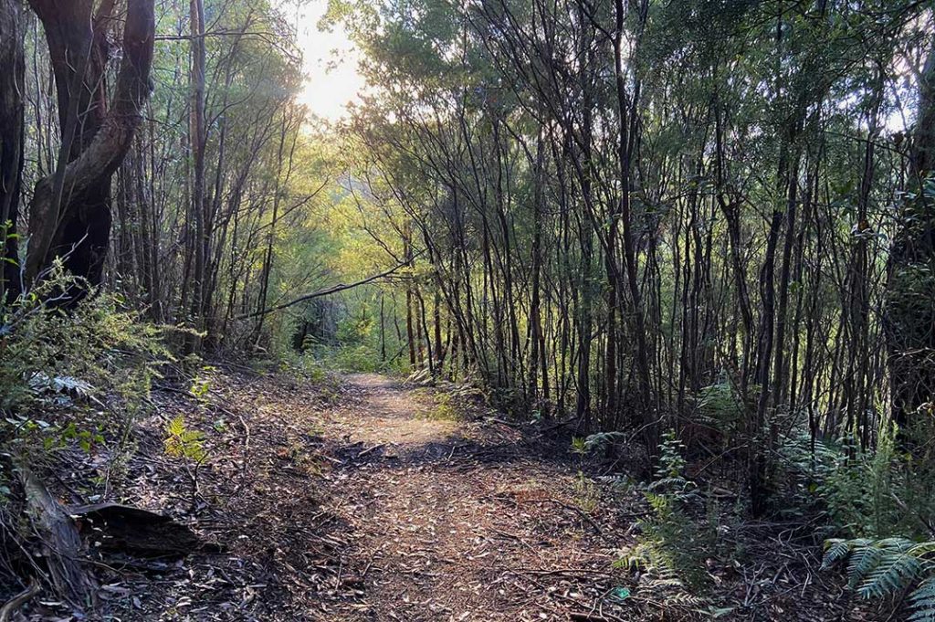
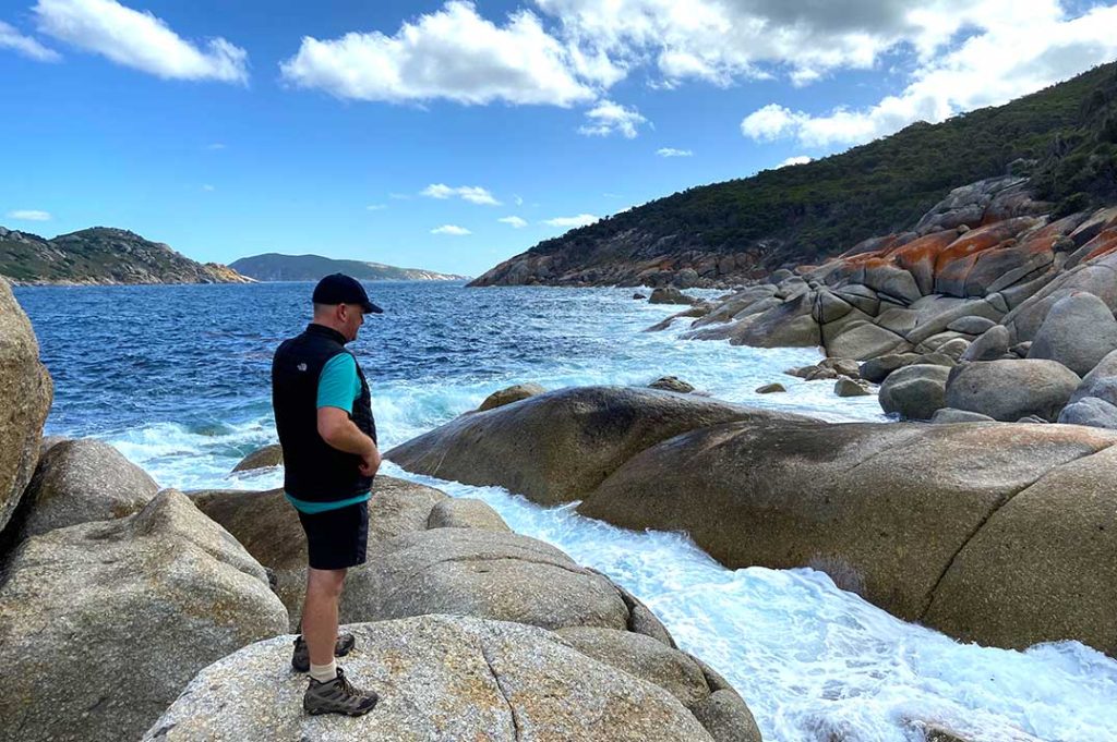
The final push takes you up and down a series of gullies, out to a few incredible viewpoints, and then down, down and down towards the very bottom of the mainland. Scribbly gums, ferns and tea trees abound, little lizards scarper into the undergrowth, closer and closer until we could hear the surf. And finally, there it was. South Point. The ubiquitous sign. The welcoming ocean. A string of islands stretching into the distance. Tasmania, the deep blue sea and then Antarctica. We dropped our backpacks, wandered out to take in the view, and breathe….
Even if you hadn’t waited for years to get here, it felt like a pretty special place. It also helped, of course, that the weather was perfect. Although the sun was bright and warm there was a chill in the air, a hint of Autumn, and combined with the wind it was just enough to cool you down after a strenuous hike. We explored a little bit, and eventually, settled into hollows in the rock. Our heads resting on our packs watching the waves. Taking it all in, and enjoying the peace and tranquillity of the moment. Ahhhh…

Eventually, this blissful rest had to come to an end, and we headed back up to camp where another five or six tents had appeared. We said hello, but most people were happy keeping to themselves. And so we celebrated on our own that evening. Also lightened our packs by finishing off a half bottle of Gin and a small bottle of Whisky. Did I mention we’re both Scottish? We tried to keep the laughter down (not to upset our self-isolating campers) but I’m not sure how successful we were. It was great though, and exactly the tonic we needed.
The trek to the lighthouse in the morning began rather rudely, we thought, with a constant incline for half an hour or so. But when we crested the hill and saw through the trees, the sparkling Southern Ocean was all the reward we needed.
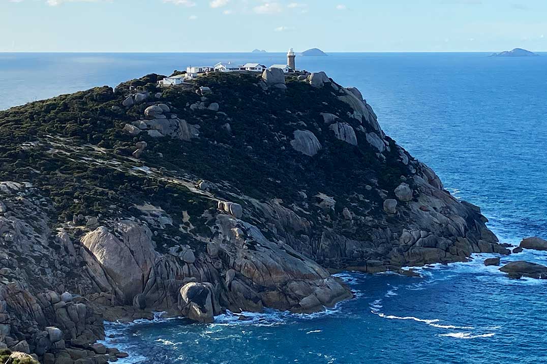
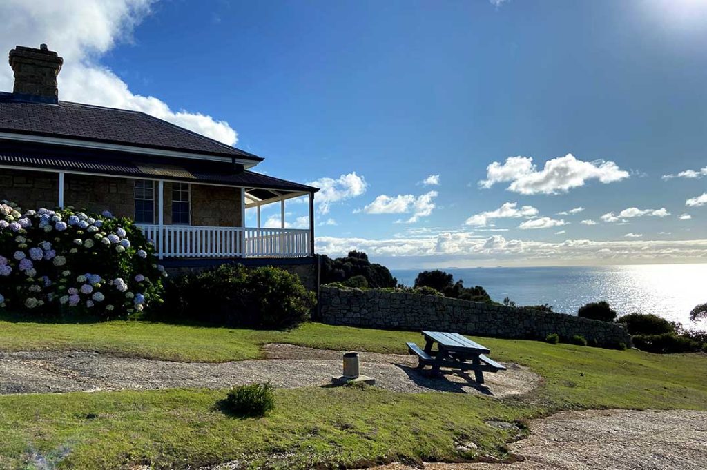
From here on, the small path clings tightly to the side of the cliffs as you wind your way around the coast, constantly within sight of your destination – a little peninsula poking out into the blue. A collection of stark white buildings perched on top. The lighthouse gazing out to infinity. Once again it was down and down towards the ocean, and when you reached the beginning of the peninsula, a steep but short walk to the top. Phew! At last, time for a mid-morning snack at the most picturesque picnic table I think I‘ve ever seen.

It really did feel like the edge of the world, and as you read the history of the place in the little museum, the sentiment is most certainly confirmed. Take the story of Captain Thomas Musgrave, for example, a sailor who’d been shipwrecked, stranded and eventually jury rigged a dingy – sailing to safety with his crew months later. Promising not to return to sea he and his wife, Catherine, moved into the lighthouse with their family in 1869. There was no way of communicating with the outside world, and supplies arrived by boat only twice a year, so you could say they were a little out of touch with current affairs.
And while Custer made his last stand, Alexander Graham Bell made his first telephone and Levi put the finishing touches to his jeans, the Musgraves buried two children and kept the lighthouse burning for nine years, saving countless lives in the process.
Something to consider while enduring our own isolation, surrounded by convenience and communication. When we think of hardship. Well, I think it also helps to consider perspective. The phone started beeping and I checked in case there were any important messages. But I didn’t want to see the news, or hear anything about what was happening back in the real world. That can wait until later. I took a final look out to the ocean. Braced myself against a wind that had travelled more than half way round the planet. Steeled myself for the unknown, walked back from the brink and set course for home.


No Comments